Differenze tra le versioni di "Wikimedia news/numero 85/en"
| Riga 36: | Riga 36: | ||
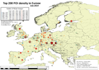
[[File:OSM.png|thumb|200px|left| OpenStreetMap with a [https://cquest.hackpad.com/OpenStreetMap-goes-in-the-4th-dimension--ju3XWhj2qAV "fourth dimension" in time], rendering by Christian Quest]] | [[File:OSM.png|thumb|200px|left| OpenStreetMap with a [https://cquest.hackpad.com/OpenStreetMap-goes-in-the-4th-dimension--ju3XWhj2qAV "fourth dimension" in time], rendering by Christian Quest]] | ||
<br> | <br> | ||
| − | * Mapillary, | + | * Mapillary, the crowdsourced "Street View" is compatible with OpenStreetMap (the images can be re-used for non commercial purposes and for extracting data for OpenStreetMap), [http://blog.mapillary.com/news%2C/update/2014/08/19/id.html it is integrated with iD editor] thanks to an extension showing the images of the surroundings. |
| − | * La Stampa | + | * Newspaper La Stampa uses OpenStreetMap as cartographic source for the visualization on [http://www.lastampa.it/2014/08/20/esteri/da-pearl-a-foley-la-mappa-dellorrore-delle-videoesecuzioni-Ynk9EfNZlCWEamAurhUogJ/pagina.html a news article]. |
| − | * Stamen Design [http://content.stamen.com/new_knight_grant_new_toner_new_infrastructure | + | * Stamen Design [http://content.stamen.com/new_knight_grant_new_toner_new_infrastructure got a new grant] from Knight Foundation to continue and update the work that, a couple of years ago, produced its Toner, Terrain e Watercolor maps. |
<br style="clear: both"> | <br style="clear: both"> | ||
Versione delle 18:20, 10 set 2014
- Specimen: /Specimen
Wikimedia News n. 84, September 4th 2014
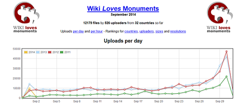
Wiki Loves Monuments 2014 started
Italy boldly joins Wiki Loves Monuments. The third edition of the picture contest started September 1st and it will go on up until the end of the month. This year there is an unprecedented participation in Italy, thanks to more than 220 institutions that freed 3500 monuments. Those numbers are going to increase even more, showing that Italian public administrations are more receptive in spreading free knowledge and sharing of cultural heritage. This year we are pleased by the joining of the MiBACT, il Ministero dei Beni e delle Attività Culturali e del Turismo, that supports the contest and invited national Soprintendenze to do the same and free their monuments.
The 2014 edition, so rich in content, is going to acknowledge the ability of many photographers: besides the usual ten winners, who are going to get smartphones and cameras supplied by Euronics in cooperation with Sony, there will be additional special prizes, as Euronics, WWF, Spazi Medievali, Wiki Loves Busto Arsizio and Fondazione Gran Paradiso.
this is a big challenge for users, participating in a contest that spans over 36 nations, all committed to prize the cultural richness of their territories.
WMI and Tuscany region cooperate on Open Data
Cooperation on Open Knowledge between institutions and WMI is increasing. We recently signed an agreement with Regione Toscana (Tuscany region administration), that commited to increasingly release its geographical assets as Open Data.
This was possible thanks to the choice by Tuscany to facilitate the re-use of its documents containing public data, promoting also the development of open source softwares. Wikimedia Italia along with Tuscany region will foster a series of activities aimed to dissemination and use of the regional geographical assets, promoting the integration of open content released by both parties.
L'accordo ha una durata di tre anni, tacitamente rinnovabili, durante i quali Wikimedia Italia e Regione Toscana si confronteranno anche con altri Enti, Istituzioni e Soggetti Pubblici della Toscana, per "avviare progetti congiunti di affinamento ed arricchimento della conoscenza geografica, ambientale e storica, con il comune intento di favorire arricchimento, miglioramento, disponibilità e diffusione di conoscenza libera", come si legge nel testo della delibera che sancisce la convenzione.
Events
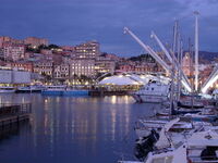
- Friday September 5th: at Salone di Rappresentanza of Palazzo Tursi, in Genoa, there was the presentazione official presentation of the contest Wiki Loves Monuments Genova' by Carla Sibilla (council member for culture), Emma Tracanella (coordinator for Wiki Loves Monuments Italia) and representatives of OpenGenova association.
- Sunday September 21th: the association Gruppo Archeologico Ambrosiano (GAAm), partner of Wikimedia Italia for the Archeowiki project, prepared a tour to Desenzano. The track contains two stops: the roman villa, with its Antiquarium, and the archaelogical museum. The tour will be hosted by one of the young guides that participated to Archeowiki during last year. More information on the official flyier (downloadable in .pdf).
News from OpenStreetMap

- Mapillary, the crowdsourced "Street View" is compatible with OpenStreetMap (the images can be re-used for non commercial purposes and for extracting data for OpenStreetMap), it is integrated with iD editor thanks to an extension showing the images of the surroundings.
- Newspaper La Stampa uses OpenStreetMap as cartographic source for the visualization on a news article.
- Stamen Design got a new grant from Knight Foundation to continue and update the work that, a couple of years ago, produced its Toner, Terrain e Watercolor maps.


